Enquire Now

Basics about Sar pass trek:
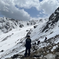
Sar Pass is a lush green landscape that is a photographer's, artist's, and nature lover's dream. The Sar Pass trek, set against a background of beautiful snow-covered Himalayan peaks, passes through some of the most breathtaking scenery, ranging from woodland to meadows to ice sheets.
Climbing from Tila Lotni to Biskeri Ridge requires passing over a little, usually frozen lake called "Sar" in Himachal's traditional language. This is how Sar Pass got its name. The path passes through deep woods to an enchanting winter wonderland.
Origin of Sar Pass Trek-Parvati Valley:
Parvati Valley has many trek routes, the most popular and challenging of which is the "Sar Pass Trek." Sar Pass was given its name for a purpose. As per the locals, It is recognized as "Sar" in their language. By Tila Lotni and Biskeri bridge, you will pass the ice lake. The natives refer to it as "Sar." It is a popular walk in the Shivalik mountain range. This climb puts hikers' stamina to the limit. It is a high-altitude climb in Himachal Pradesh.
Kasol is a renowned tourist destination regarded as the "Mini Israel of the Himalayas."
The deep green woods, crystal clear waterfalls, exciting routes, and many types of Himalayan flora and animals grace the Sar Pass Trekking trek. The first campground, Grahan Settlement, is the route's most isolated village. Here you will see classic homes created years ago and be impressed that they are still standing. Min Thatch is a green area in the wilderness, similar to a pasture where villagers used to graze their livestock.
Things to keep in mind before going to Sar Pass:
Sar Pass Trek Quick Facts:
Distance: 48 Kms
Height: 13,800 ft.
Difficulty: Easy to moderate
Start Point/End Point: Kasol Base Camp.
Reaching Sar Pass trek:
Air: The closest airport is Bhuntar Airport, which has direct flights to all major cities through Delhi and Chandigarh. The distance from Kasol to Bhuntar Airport is 32 kilometers.
Train: The closest railway station is 310 kilometers away in Chandigarh. From here, government/private transport to Kasol is readily accessible.
Road: Traveling by road to Kasol is the most sensible alternative. Buses to Bhuntar are accessible from all big towns such as Chandigarh and Delhi.
Inclusions:
Time: 4-5 hours | Height: 7,700 Ft.
Time: 4-5 hours | Height: 11,150 Ft.

Meals

Tents
Time: 5-6 hours | Height: 12,500 Ft.
Time: 6-8 hours | Height: 13,800 Ft.
Time: 4-5 hours | Height: 10,950 Ft.

Sar Pass Circuit Trek
5D 4NStarting from INR. 8000
INR. 5799 28% Off
Per AdultWe at Trippy Adventures believe in providing a hassle-free travel experience to our customers! We try to make our booking process easy and secure for you so that you can rest easy and concentrate on packing and dreaming about the experiences!

Book A Tour
Browse through our list of tours and select your preferred one!

Payment Process
Pay through our secure payment gateway for the trip of your choice.

Confirmation
Receive immediate confirmation on the registered mail id.

Enjoy Your Trip
Rest easy knowing you booked with us and have an unforgettable experience for a lifetime.
Sar Pass best treks between April and June. During this season, the passes and trails have less snow, and you may enjoy summer and snow-covered summits. After June, bad weather is likely over 4000 feet. These weather changes result in lush green woodlands, improving your view. This hike is a gem.
Beginners should hike Sar Pass. It's for people who wish to try different terrains. This path provides forests, meadows, picturesque towns, and snow-covered mountains.
When you reach higher Heights, you will encounter deep snow, and the weather in Sar Pass is charming during these months. People often mention Sar Pass Trek as among India's most beautiful hikes.